
GPS has become one of the most widely used technologies in business, regardless of industry or market sector. But why is that and what is it about the Global Positioning System that is so universally beneficial?
To understand GPS and its benefits, look to its industry-specific applications in industries as varied as logistics and agriculture. For example, GPS-enabled geofencing provides security and safety, and asset tracking improves equipment management.
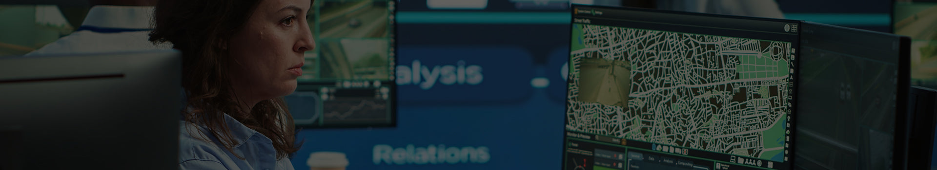
This business owner's guide to GPS tracking will explain how precise location data and advanced functionalities combine to revolutionize fleet management, route optimization, inventory management, and more. How does GPS tracking work? Let’s take a look.
What Is GPS?
GPS is shorthand for the Global Positioning System. It’s a satellite-based navigation system that provides accurate location information for navigation and other applications. A network of GPS satellites orbits the earth, transmitting radio signals which the GPS devices on the ground receive. Today, GPS receivers can be found in automobiles, smartphones, and specially designed tracking devices.
By analyzing the timing and strength of the GPS satellites’ signals, GPS receivers can calculate their precise latitude, longitude, and altitude coordinates. This data can be updated in real time, providing the basis for GPS tracking.
The Origins of GPS
GPS technology has become commonplace in the last couple of decades, but its roots lie in the Cold War era. The US military began the project that came to be known as the Global Positioning System to improve the accuracy of its missiles and bombers. The first GPS satellites were launched in the 1970s, and more have gone into orbit in the years since.
Starting in the 1980s, the US government began making GPS available for civilian use. This decision kickstarted the development of consumer—and business-grade GPS-enabled devices and applications. GPS is ubiquitous today, as the technology is used in smartphones and vehicles worldwide.
The Primary Functions of GPS
Even though the technology has many uses, you can pinpoint three primary functions of GPS:
-
Positioning: GPS's core function is to determine the precise location of a GPS receiver. A GPS receiver can pinpoint its geographic coordinates by calculating the distance between the receiver and multiple satellites. GPS positioning is essential for navigation, mapping, and geographic information systems (GIS).
-
Navigation: GPS enables navigation by providing real-time directions and guidance. By tracking the user’s current location and destination, GPS devices calculate optimal routes and provide turn-by-turn instructions. This functionality is widely used in vehicles, marine vessels, and aircraft.
-
Timing: GPS provides highly accurate time signals. GPS receivers maintain precise timekeeping by synchronizing with the atomic clocks on GPS satellites. GPS’s precise timing is used in telecommunications, financial systems, and scientific research, among other applications.
How Does GPS Tracking Work?
To understand how GPS tracking works, it helps to think of it as a combination of three segments:
The Space Segment
At the heart of the GPS system is the constellation of satellites that orbit the Earth. These satellites transmit radio signals containing orbital data and precise timing information, broadcasting these signals continuously over the entire planet.
The Control Segment
Back on Earth, a network of ground stations monitors and controls the GPS satellites. Ground stations not only track the satellites’ orbits but can also adjust their positions to ensure the accuracy of the time signals. The control segment essentially maintains the integrity of the GPS system.
The User Segment
The user segment consists of various GPS receivers, whether in smartphones or specialized tracking devices. Each receiver picks up signals from multiple GPS satellites. Receivers process the signals with a technique known as trilateration to determine the receiver’s location more accurately.
What Is Trilateration?
Trilateration ensures that GPS receivers provide precise location data. Instead of receiving signals from just one source, a GPS receiver picks up transmission from at least four GPS satellites. The receiver precisely measures the time it takes for each signal to reach it. Using the speed of light as a base figure, the receiver can calculate the distance to each satellite. Each distance measurement is used to define a sphere centered on the satellite, with a radius equal to the calculated distance. The intersection of the three spheres determines the receiver’s three-dimensional position—latitude, longitude, and altitude.
The Fourth Satellite Signal: The Importance of Precise Timing
Although the process is known as trilateration and calculations are based on three measurements, recall that the process uses at least four GPS satellites. Accurate timing is critical for GPS to function correctly, and three signals alone don’t provide the required accuracy.
While the GPS satellites have highly accurate atomic clocks, the receivers don’t. The result is a slight time offset between the receiver’s clock and the satellite’s clock. By incorporating a fourth satellite signal, receivers can resolve the offset and correct for it during trilateration calculations.
How Does GPS Work Without the Internet?
While most other location-based services rely on a cellular or Wi-Fi internet connection, GPS receivers directly communicate with satellites in orbit. This internet-free communication enables GPS receivers to provide accurate location information in remote areas or when there is no cellular service.
For navigation applications, GPS devices can utilize offline maps. GPS navigation devices typically come preloaded with offline maps which can be used when there’s no data connectivity. Offline GPS lacks some modern navigation features like real-time traffic updates. Outdated map data can also lead to inaccurate navigation. Despite these limitations, offline GPS is a powerful tool that other location services can’t match.
What Does a GPS Tracker Show?
GPS trackers offer a wealth of data that businesses across all industries find invaluable. This includes:
-
Real-time location data: The fundamental function of any GPS tracker is to provide the exact geographic coordinates of the tracked asset, with updates in real time.
-
Speed tracking: GPS calculations can provide the speed of moving objects. Businesses can use this data to optimize routes and improve fuel efficiency.
-
Route history: GPS units record the historical movements of tracked assets. This history can be visualized on a map so that businesses can identify patterns and optimize routes.
-
Geofencing alerts: Geofencing is a software feature that allows users to define virtual boundaries. Businesses can receive instant alerts when a tracked asset enters or exits a geofence, adding security to business workflows.
-
Environmental monitoring: Advanced GPS trackers feature sensors to monitor temperature, humidity, and other environmental factors. This data helps maintain optimal conditions in industries like transportation and logistics.
How Do I Choose the Right GPS Tracking System for My Business?
With so many options on the market, selecting the right GPS tracking system for your business is rarely straightforward. Following these steps can help you make an informed decision:
-
Identify your needs: Determine the assets you want to track, like vehicles or equipment. Consider whether you need features like real-time tracking, geofencing, or environmental monitoring.
-
Consider scalability: Ensure a GPS tracking system can accommodate your business’s future growth by looking for scalable solutions that can grow with your needs.
-
Define integration requirements: Decide if your GPS system should integrate with your existing business hardware and software, such as fleet management or telematics systems.
-
Prioritize data security and privacy: Find a GPS system that values data security and employee privacy. Look for systems that offer data encryption and compliance with privacy regulations.
-
Perform a cost-benefit analysis: List and total the upfront costs of GPS hardware, software, and installation. Next, evaluate monthly subscription fees, data plans, and maintenance costs. Calculate the potential savings and efficiency gains to determine the expected ROI.
-
Look for reliable customer support: Assess the quality of customer support for all GPS vendors you consider to ensure a mutually beneficial partnership.
-
Don’t forget user-friendliness: Look for GPS software with a user-friendly interface and easy navigation. Consider if you need a mobile app to access real-time tracking data on the go.
GPS Tracking for Small Businesses
GPS tracking isn’t just for large corporations. Small businesses have just as many (or more) challenges that can be overcome by leveraging GPS technology. Here are some things small businesses should consider when choosing GPS tracking systems:
Affordable Solutions for Limited Budgets
The perceived costs of a GPS tracking system often keep small businesses from investing in the technology. However, there are affordable solutions that can deliver significant benefits, even with limited budgets.
Opt for subscription-based services with flexible pay-as-you-go plans. Invest in budget-friendly GPS tracking devices that offer the essential features like real-time tracking and geofencing. Consider lightweight racking systems that can be easily moved between tracked assets.
Scalability for Future Growth
As your business grows, your GPS tracking needs will likely evolve, too. Look for a system that can scale with you. Choose a provider offering scalable pricing plans, allowing you to add devices and features as needed.
Just make sure the system you choose integrates with your other business applications. Integrations can streamline your operations and maximize your technology investments. If you think you’ll need GPS data presented in customized reports as your business scales, ensure the system you choose provides this option.
GPS Tracking for Large-Scale Operations
Larger businesses, like logistics companies, construction firms, and transportation providers, must carefully consider their needs before investing in GPS tracking solutions. Here are some ways large-scale businesses can succeed with GPS:
Managing Complex Fleets
For businesses with large fleets, GPS tracking provides the tools to streamline complex operations. With real-time visibility into the location and status of every vehicle in the fleet, you can optimize resource allocation by tracking vehicle utilization and identifying idle time.
Look for a system with centralized dashboards that allow you to quickly monitor and analyze fleet performance. Find a system that can track driver behavior, such as speeding, harsh braking, or excessive idling, so that these issues can be addressed for safety and efficiency.
Centralized Data and Analytics
Centralizing fleet data is an important step for large organizations that want to gain valuable insights into their operations. For example, you might want to integrate GPS tracking data with your business’s ERP system to improve visibility across the supply chain.
Whether through an ERP integration or with GPS software platforms, leverage advanced analytics to identify trends, optimize routes, and implement a predictive maintenance schedule. Use historical GPS data in detailed reports as proof of regulatory compliance. Analyzing this same data can help find opportunities for optimizing routes and driver behavior.
Industry-Specific Applications of GPS Tracking
GPS tracking can solve unique business challenges and optimize workflows, from logistics to agriculture to healthcare and retail. Consider these examples:
-
Transportation and logistics: Real-time delivery tracking improves transparency and increases customer satisfaction. Route optimization reduces fuel consumption, and smarter routing decreases delivery times. Monitoring goods in transit ensures safe and timely deliveries.
-
Agriculture and farming: Using GPS to map fields, optimize planting schedules, and monitor soil health leads to precise farming workflows. Equipment tracking ensures proper usage and maintenance of windows for tractors and machinery.
-
Healthcare and emergency services: Reduce response times by using GPS to locate the nearest available ambulance. Track medical supplies to ensure timely delivery of critical medicines or life-saving equipment.
-
Retail and e-commerce: Enhance last-mile logistics for delivery efficiency. Track high-value products to reduce theft and loss.
Frequently Asked Questions (FAQs)
What Are the Limitations of GPS?
GPS is a highly reliable and versatile technology. Most limitations occur on the receiver end, as buildings, tunnels, dense foliage, and other obstructions can block GPS signals. Atmospheric conditions can also interfere with signal reception. In urban areas, signals bouncing off reflective surfaces lead to a phenomenon known as multipath interference. Work with a trusted GPS provider to address any of these issues in your business applications.
How Accurate Is GPS?
In ideal conditions, GPS can provide accuracy within a few meters. In challenging environments where a receiver suffers from interference, accuracy may be reduced to tens of meters or more.
What Is Geofencing?
Geofencing uses GPS software to define a virtual geographic boundary around a specific area. An alert or other action is triggered when a GPS-enabled device exits or enters a geofenced area. By responding promptly to these alerts, businesses can reduce the risk of theft, loss, or safety issues.
Empower Your Business With LandAirSea
As this guide shows, GPS tracking has the potential to transform nearly any business across all industries. From optimized inventory management to geofencing alerts, the right GPS system can transform both small companies and large-scale operations. To ensure you maximize your investment in GPS technology, you need an experienced partner who can help you find the right combination of hardware, software, and features.
LandAirSea’s GPS systems have been used by small and large businesses in multiple industries. Our experienced consulting team can find the optimal GPS solutions for your business and provide you with real-time insights into your operations. To learn more about LandAirSea, our products, and our services, contact us today.